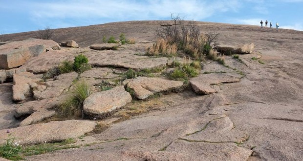
The spectacular Enchanted Rock dome that today draws thousands of hikers and climbers is just the most visible part of that hidden batholith, revealed after millions of years of erosion of the rock above.
The park’s trails weave over, around and in between Enchanted Rock and its more diminutive neighbors – Freshman Mountain, Turkey Peak, Buzzard’s Roost and Little Rock. An outer loop of about 4 miles encircles the web of inner trails.
If you’re going to do one trail, make it the short Summit Trail. It’s just over a half mile each way and a bit more if you wander around the dome. In that space it climbs about 425 feet to a height of 1,825 feet – enough to get you huffing and puffing. Even if you plan on doing some of the other trails, start here because you may not have the energy later.
Much of the hiking is over bare rock and small boulders. Scattered across the dome you’ll run across small depressions – vernal pools that gather rainwater and accumulate soil, creating oval ponds and diminutive gardens with grasses, flowers and brush that stand out from the bare rock. Across this landscape,
… you can see the progressive development [of the vernal pools] from bare rock-bottom pits, to annual plant establishment, to miniature prairies with grasses like little blue stem or even trees like live oak. Vernal pools also support an interesting species of invertebrate, the fairy shrimp. These animals survive total desiccation as fertilized eggs, and hatch into larvae and grow into adults each time water collects after sufficient rainfall.
Near the center of the dome is the entrance to a small cave that if nothing else will shelter you for a while from the hot sun.
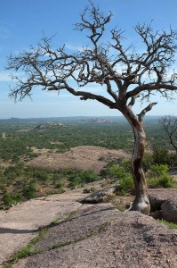
If you take in the big picture, you’ll see the valley stretching out in the distance, nearby rocky outcrops and the outlines of Moss Lake on the outer trail. On the edges of Enchanted Rock and its neighbors, a type of erosion called exfoliation peels slabs away from the dome like the skin of an onion.
Down from the summit, you can start out on the Loop Trail, which initially follows the bed of Sandy Creek and is strewn in the spring with bluebonnets and other wildflowers. Depending on recent rainfall, the creek bed can be alternately dry and scattered with quiet pools of water among the grasses.
A short way in, the Turkey Pass Trail (0.65 mile) veers off to the left between Enchanted Rock and Turkey Peak. It passes by Frog Pond, which until there is more rainfall should really be called Frog Flats.
Take the outer Loop Trail the entire way and you’ll hike four miles back to your starting point, passing Moss Lake with the Enchanted Rock Dome rising in the distance. Take the Turkey Pass Trail down one side of the dome and come back the Echo Canyon Trail on the other side and you’ll get closer views of the dome and shave two miles off your hike, though the last stretch of the Echo Canyon Trail requires a bit of clambering over small boulders.
Start out early to avoid the crowds. By late morning on a recent visit, groups were swarming the dome, including a young man who took advantage of the majestic backdrop to propose to his girlfriend.
PARK GALLERY


You must be logged in to post a comment.