At a glance
Distance: 1 mile rountrip
Elevation change: 75 feet
Hiking time: 1 hour
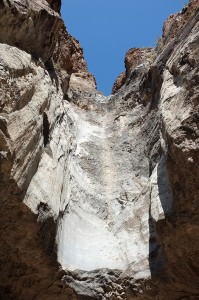
Highlights: Desert flora, multicolored cliffs and a pour-off carved in granite at the end
Difficulty: ★★☆☆☆
A short, flat walk between bluffs
Trail conditions: ★★★☆☆
The trail follows a sandy wash; so, while it’s not well marked, you can’t get lost.
Scenery: ★★★☆☆
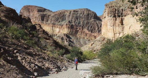
Multicolored volcanic bluffs line a desert trail that leads up to the sculptured pour-off
Solitude: ★★★☆☆
Moderately crowded because it’s short and easy, but it’s not among the most popular trails.
Other reviews
• On Texashiking.com
• On Everytrail.com
The dark basalt and conglomerate at the bottom of bluff – much of which is buried in eroded sediment – is the same volcanic rock that lies under the Chisos Mountains to the east.
About 30 million years ago, new volcanic flows poured over the top of those Chisos rocks from nearby vents, producing the dark Burro Mesa rhyolite at the top of the bluff and the light yellow wedge of the Wasp Spring breccia immediately below it. It was the last significant volcanic activity in Big Bend. The entire lineup is a mirror of the rocks along the South Rim, only dropped several thousand feet here by subsequent faulting.The trail climbs slightly through the desert before dipping into the sandy wash that leads into the canyon. From there, it veers into the box canyon to the right, following a rocky wash strewn with with Texas persimmon. It snakes around to the left, where the pour-off looms ahead.
There are two Burro Mesa Trails – this one, which ends at the bottom of the chute, and the longer trail above that ends at the top. During heavy summer rains, the water shoots through the canyon above, down the pour-off and out through the wash.


You must be logged in to post a comment.