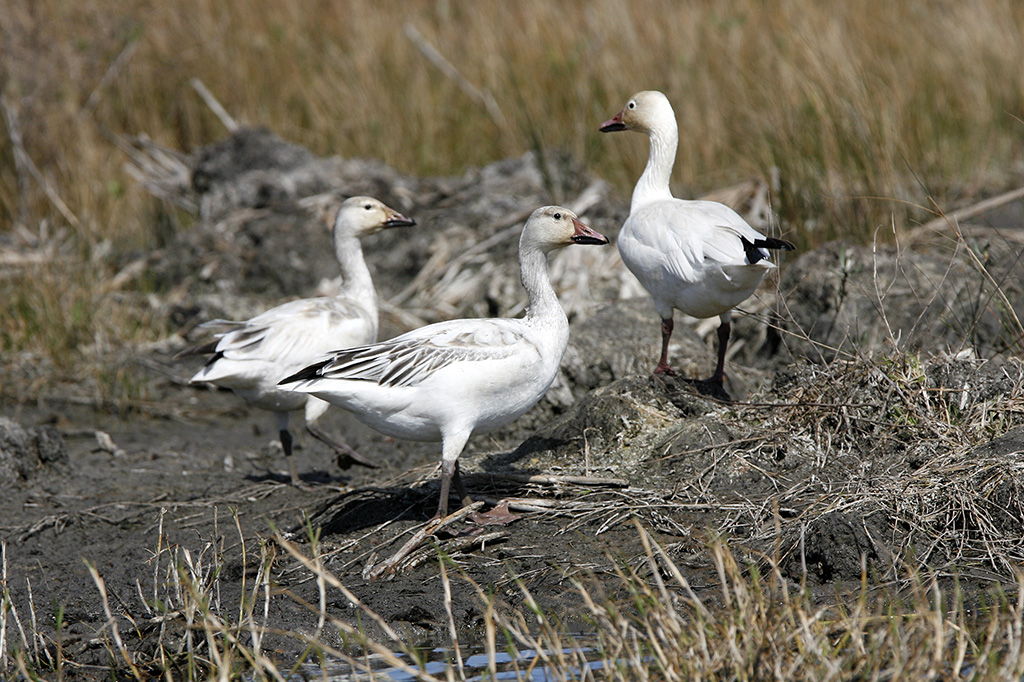
A trio of Snow Geese
Five species of geese reach their peak numbers during December and January, while 24 species of ducks arrive October through March. The high season for raptors is in the fall, when Merlins, Red-tailed and Broadwing Hawks, American Kestrels, Peregrine Falcons and Crested Caracaras soar above the marsh and prairie.
At various times of the year, the refuge is home to more than 320 bird species, along with other wildlife. Rachel Jenkins of the Texas State Historical Association explains:
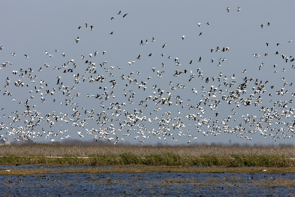
The upland prairies hosts wildlife including coyotes and bobcats, while the shore area hosts herons, ibis, sandpipers, avocets, and stilts. More uncommon marsh and water birds, including roseate spoonbills, white-faced ibis, and yellow rails, make seasonal appearances. Several islands in the Cedar Lakes area support a colonial waterbird rookery used annually by over 8,000 nesting pairs of fifteen different species, including royal terns, laughing gulls, and Louisiana herons…. San Bernard National Wildlife Refuge, along with other such refuges on the Texas Gulf Coast, provides essential winter habitat for birds on the Central Flyway, one of four major migratory routes over the continental United States. During the winter months duck and geese populations reach peaks as high as 35,000 and 90,000, respectively.
There are several ways to see the refuge – on the road, on foot or on bicycle. Almost 10 miles of “car trails” snake around the ponds and marshland, highlighted by a large three-mile loop around Moccasin Pond. Staying in the car is a good idea when the flies and mosquitoes are heavy. A half-dozen short hiking trails branch off from the road into the marsh and brush.
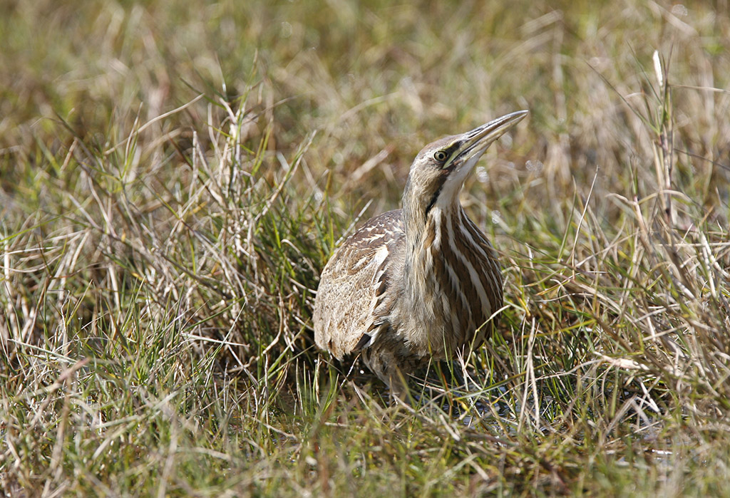
American Bittern in the grass
Cocklebur Slough Road. Beginning at the entrance, the road runs along Cocklebur Slough, through forest and grasslands, and ends at the Cedar Lake Creek fishing pier. It’s a good place to see warblers, raptors and wading birds. The Bobcat Woods, Cedar Lake Creek and Scissor-tail trails come off this road, as does the Moccasin Pond Loop.
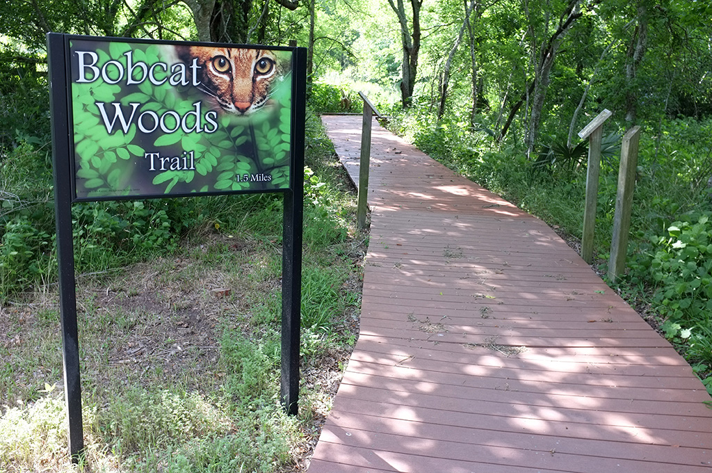
Bobcat Woods Trail (1.5 miles). This boardwalk trail runs along Cocklebur Slough through trees dripping with Spanish moss. In summer, the mosquitoes are sometimes unbearable. A small butterfly flower garden with a swinging gate graces the trailhead and one end of the trail leads to the Wolfweeds Wetlands area.
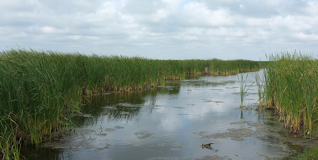
Wolfweed Wetlands. Wolfweed is among the largest stretches of water on the refuge – part pond, part marsh, part mudflat depending on recent rainfall. A large observation deck overlooks the water, while trails follow the tall levees that surround and divide the wetlands. Look for the eyes of alligators laying still in the water and large flocks of Snow Geese in the winter.
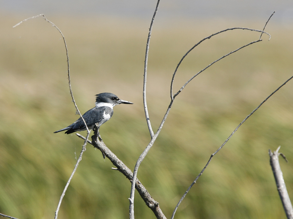
Belted Kingfisher near Moccasin Pond
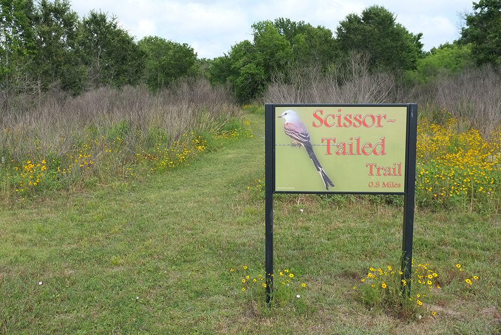
Scissor-tail Trail (0.8 mile). A short loop through a light forest on the edge of Cocklebur Slough, the grassy Scissor-tail Trail is a great place to look for warblers and other songbirds during “fallouts” in the spring.
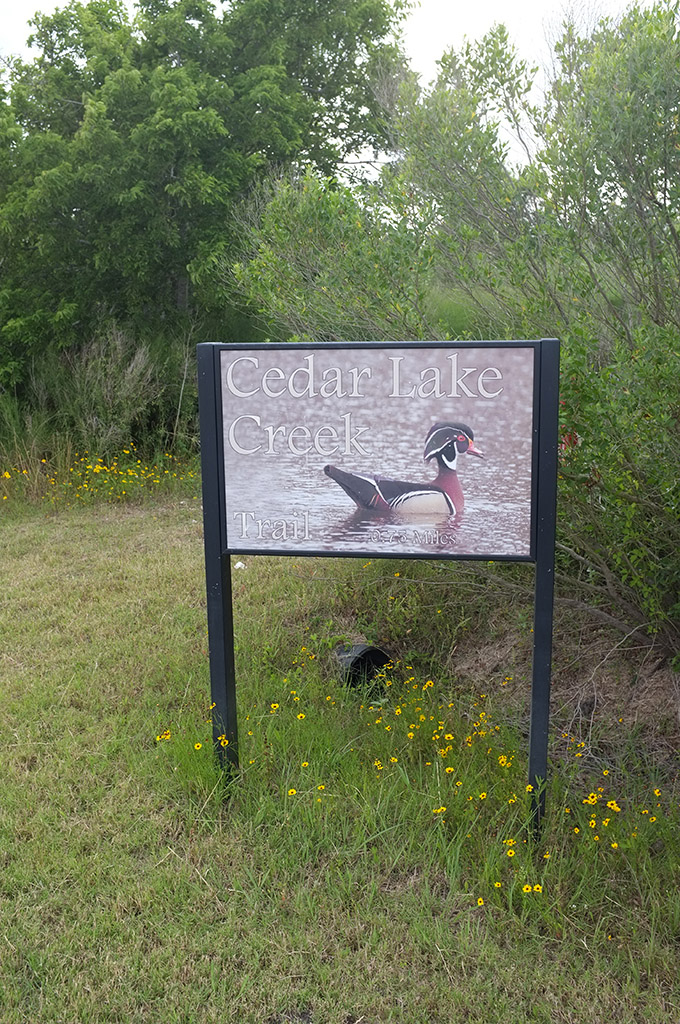
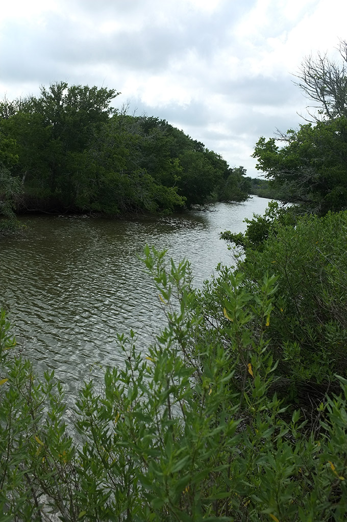
Cedar Lake Creek Trail. This short, grassy trail begins near the fishing pier on Cedar Lake Creek and follows along the creek with several openings for fishing or wildlife viewing. From the pier, you can launch canoes and kayaks.
Moccasin Pond Loop. The road circles a patchwork of ponds and marshland where you may see Roseate Spoonbills, Ibises, Black-necked Stilts, American Avocets and other migratory and resident waterfowl. On the drier far side, look for Scissor-tailed Flycatchers and other birds darting across the road. An alternative exit past Rail Pond is sometimes open and comes out near the refuge headquarters on County Road 306.
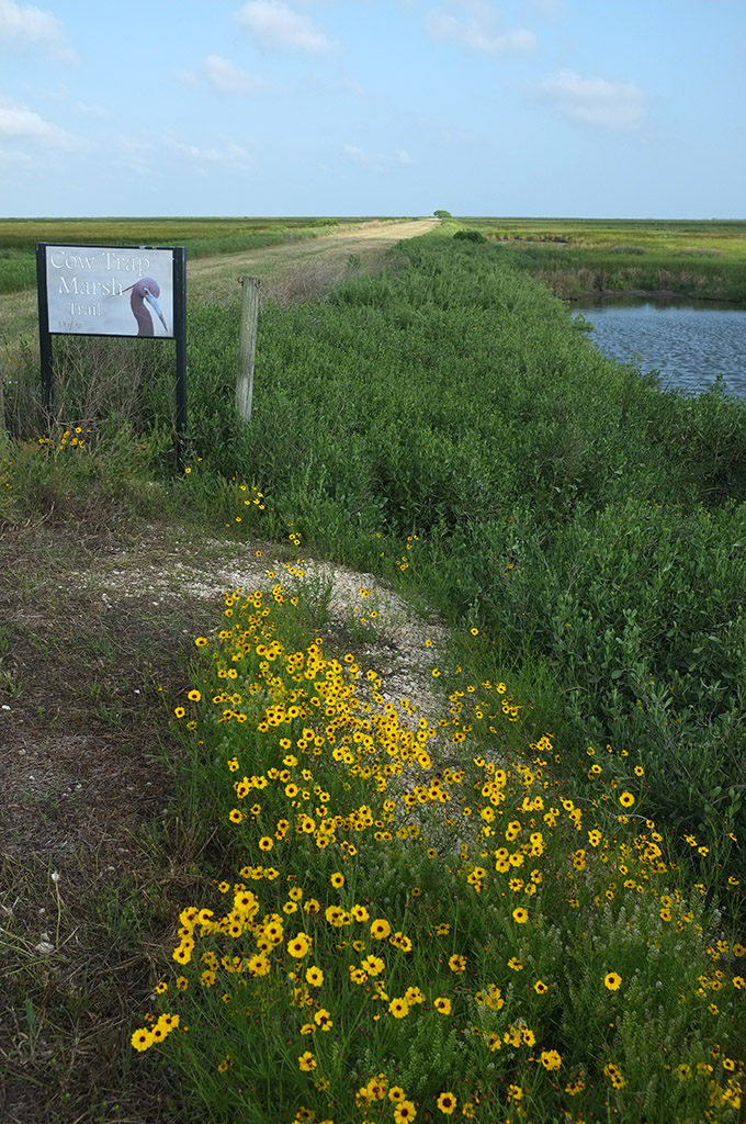
Cowtrap Trail. The Cowtrap Marsh Trail branches off of the Moccasin Pond Loop and leads along a 1.5 mile levee into the vast marshland that covers the bulk of the refuge.
San Bernard Oak Trail. This 1.5 mile interpretive hike – on the opposite side of CR 306 – takes you to the largest live oak in Texas and requires registration either in person or by phone at the refuge headquarters.
Besides the main area above, there are several other accessible trails on the refuge. The 10-acre Betty Brown Birding Trail borders the Bernard River, while the Hudson Woods unit, off CR 521, offers several hiking trails, including:
- Scoobey Lake Trai, a 1.9-mile loop around Scoobey Lake and its 16-acre island
- Willow Oxbow Trail, a 2.7-mile walk that passes a 60-acre oxbow lake
- Oyster Creek Trail, a 3.5-mile hike that starts at Scoobey Lake and follows Oyster Creek to the Willow Oxbow Trail
REFUGE GALLERY


