At a glance
Distance: 1.6 miles roundtrip
Elevation change: 80 feet
Hiking time: 1 hour
Highlights: Steep canyon walls with dramatic lighting and a winding river below
Difficulty: ★★★☆☆
After a stair-step climb at the start, it’s a leisurely walk.
Trail conditions: ★★★☆☆
The first part of the trail is easy to follow but there’s some scrambling over rocks and vegetation at the end for the best views.
Scenery: ★★★★☆
Steep canyon walls leading to spectacular views of the river and canyon, particularly in morning or late afternoon light.
Solitude: ★★☆☆☆
An easy trail with spectacular views attracts a crowd.
• On Texashiking.com
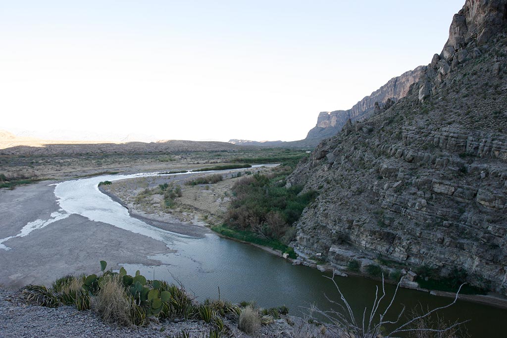
The Santa Elena Canyon trail in
Big Bend follows the Rio Grande upstream through steep canyon walls on the Mexican border. At the
trail head a boardwalk over the sand takes you to the
mouth of the canyon.
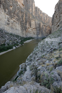
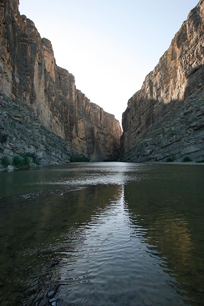
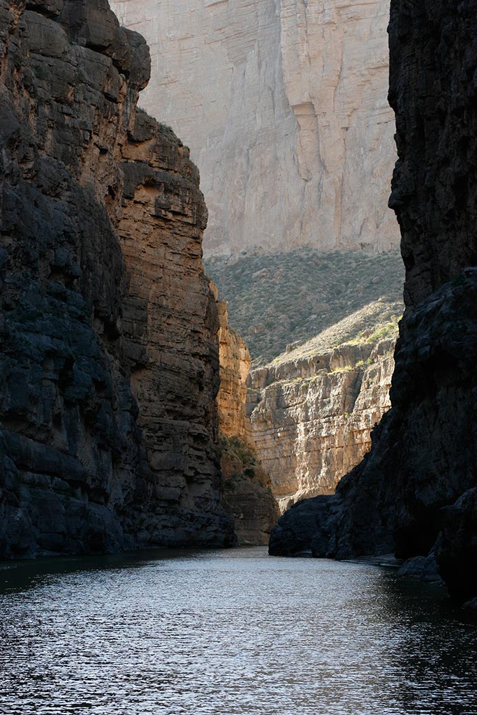
The Rio Grande in the canyon
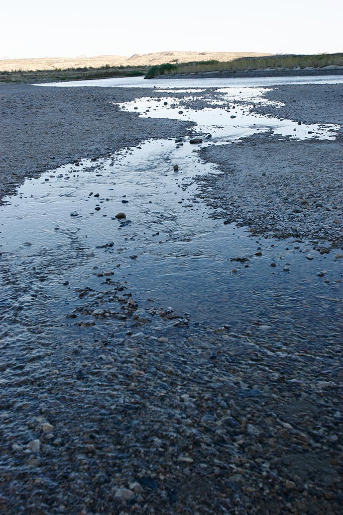
The trail first crosses
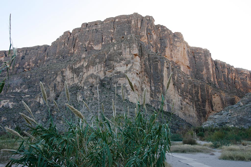
Terlingua Creek, which can be everything from a swiftly flowing stream to nothing but dry stones. At the entrance to the canyon, the trail climbs about 80 feet of stairs, offering dramatic views of both the canyon and
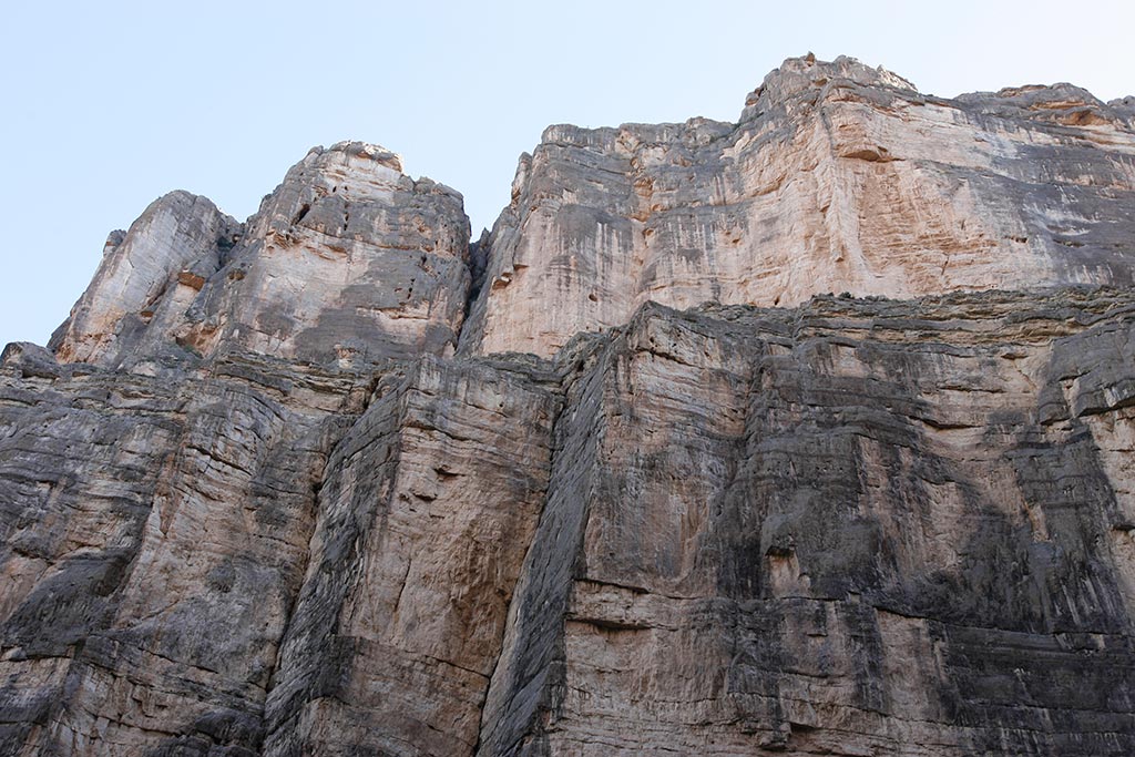
river valley, before descending on the other side to the banks of the Rio Grande. The colorful limestone
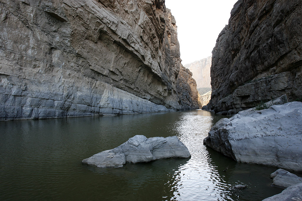
walls of the canyon loom 1,500 feet on either side of the river and chronicle more than 100 million years of geologic history as primitive seas flooded and retreated over the landscape.
The Rio Grande is sandwiched between Mesa de Anguila on the right and the sheer wall of Sierra Ponce in Mexico on the left. The layers of rock laid bare begin with hard Santa Elena limestone at the top, dropping through Sue Peaks and Del Carmen limestones before reaching a thin layer of Telephone Canyon marl and limestone at the water.
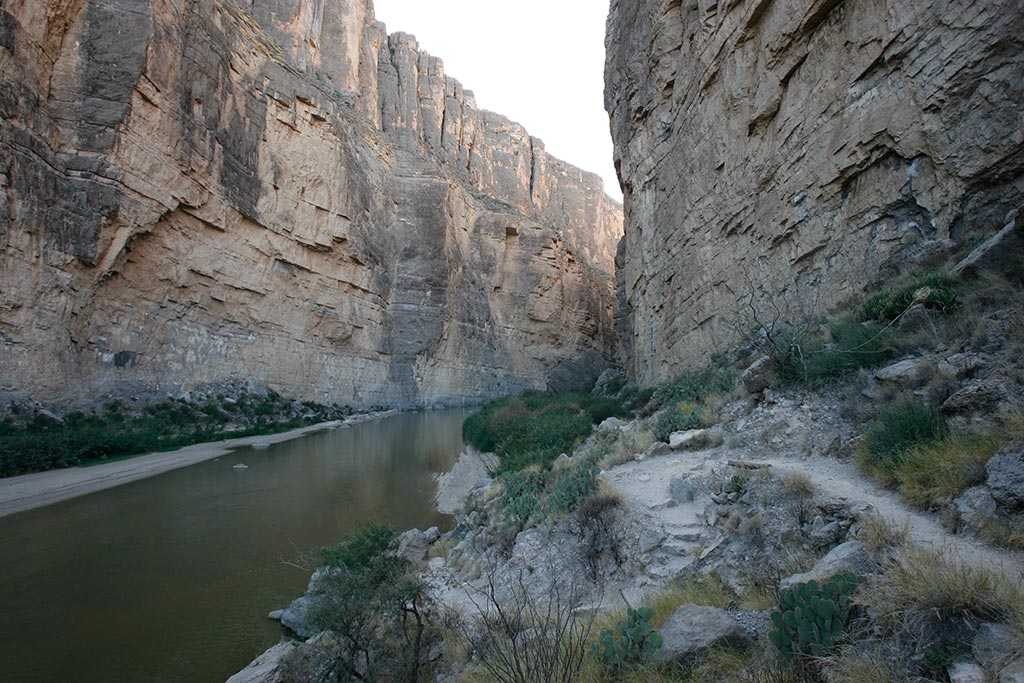
With the tall walls and narrow pathway between them, the trail is
fortuitously shaded much of the time. As it reaches the
sandy banks of the river, the trail becomes less distinct. To get to the most
dramatic views at the bend in the canyon requires clambering over a few rocks and wading around clumps of giant river cane and tamarisk. The trail ends where the river cuts it off at the canyon wall.
To see more of the canyon, you’ll need to clamber into a raft.
