At a glance
Distance: 4.8 miles roundtrip
Elevation change: 1,300 feet
Hiking time: 2.5 to 3.5 hours, depending on how much time you spend at the top
Highlights: Panoramic views of Juniper Canyon, Casa Grande, the “Window” and a “top of the world” feel at the end of the trail.
Difficulty: ★★★☆☆
The climb is steady but not steep, except in a couple of short stretches
Trail conditions: ★★★★☆
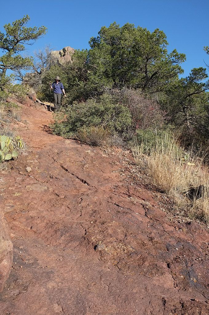
The rocky dirt path is well traveled and easy to follow.
Scenery: ★★★★★
Except for the South Rim, the trail offers probably the most beautiful views of the canyons, peaks and rough beauty of the Chisos Mountains.
Solitude: ★★☆☆☆
It’s one of the most popular hikes in the park, but if you start at dawn you’ll see most of the other hikers on the way back.
Other reviews
• Park Service’s 1956 guide
• Texashiking’s trail review
• Lost Mine by trail markers

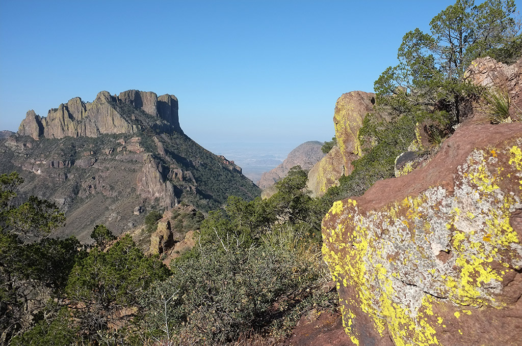
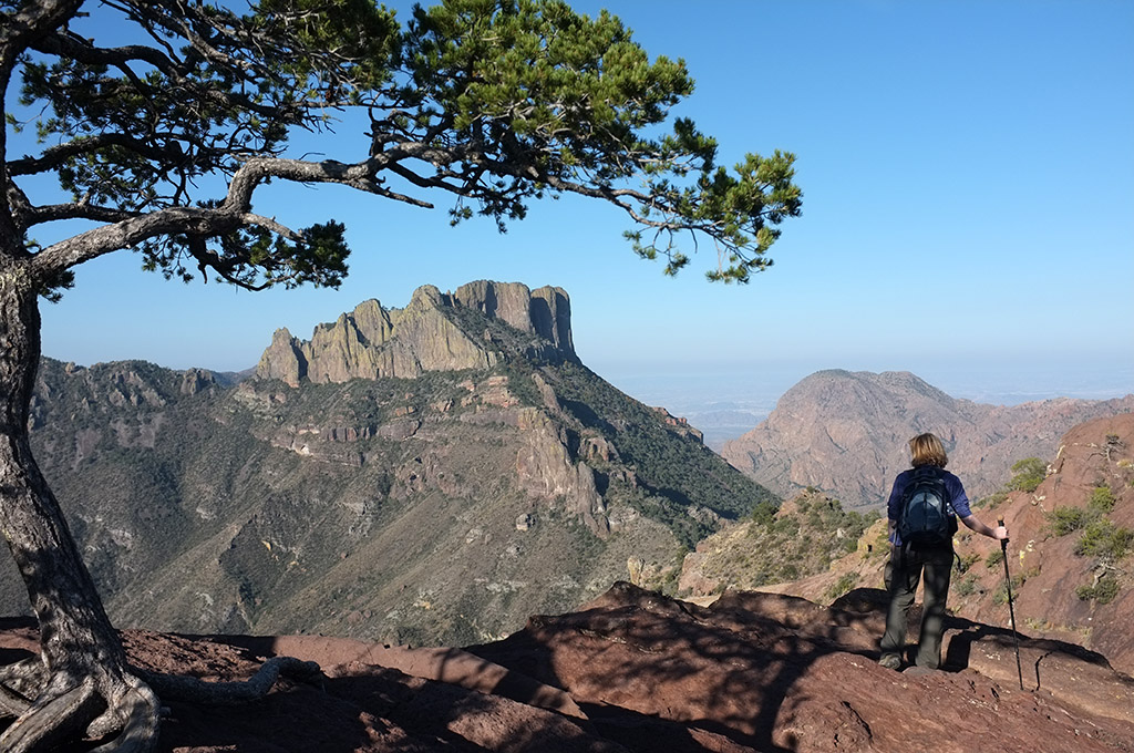
Looking back toward “The Window”
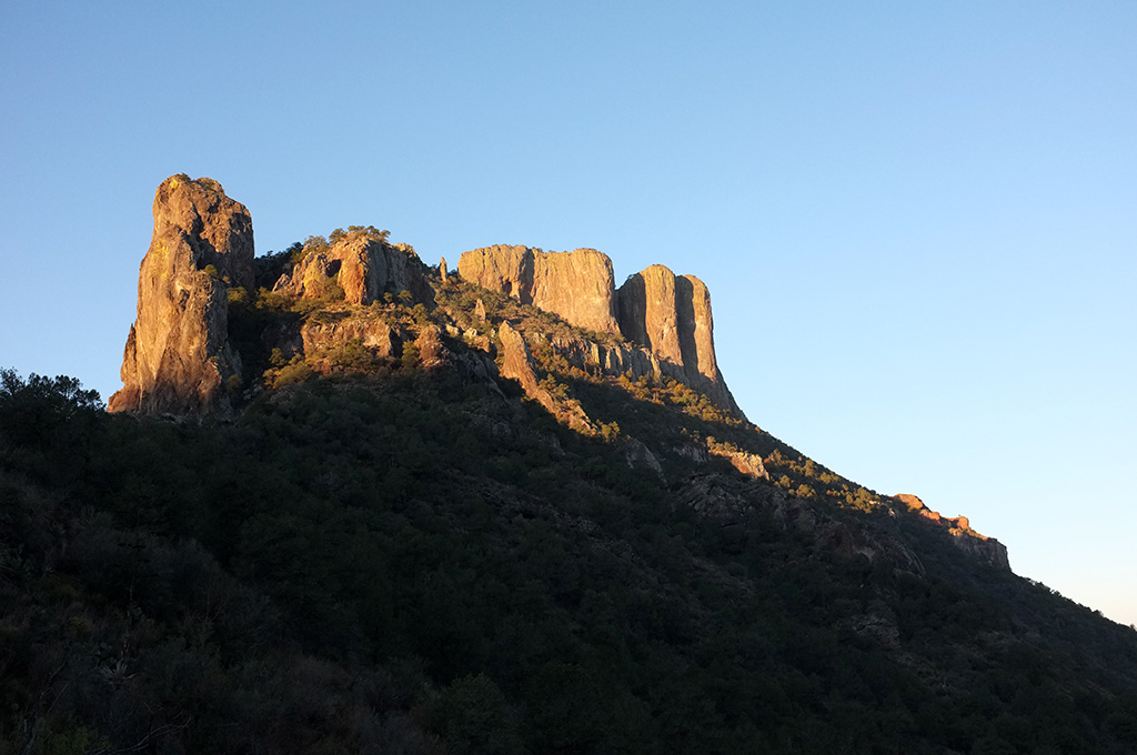
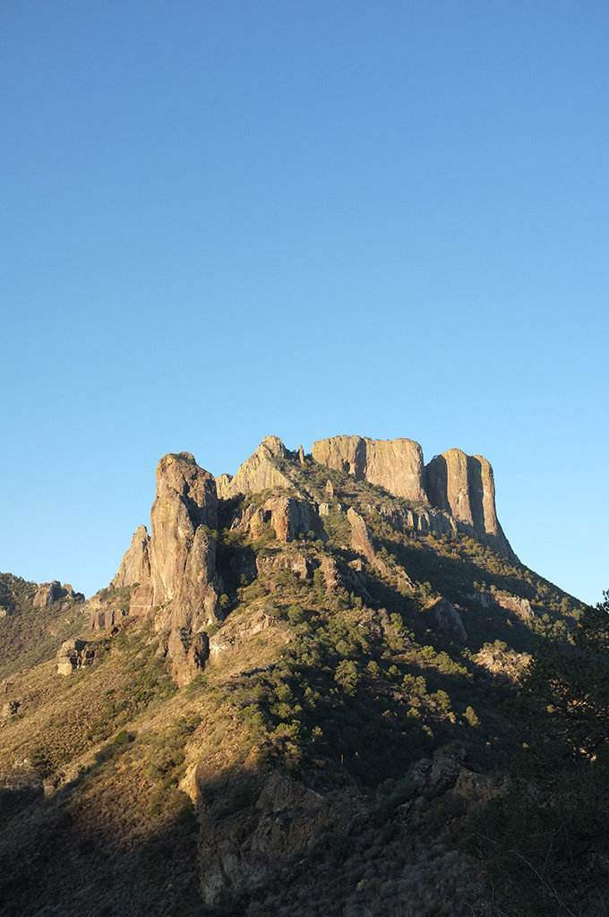
The early part of the trail is a moderate climb through Mexican pinyon pine, juniper and scrubby oak, with a ground cover of light grasses. Amid those more common trees, you’ll see Alligator and Mexican Drooping Juniper and the distinctive Texas Madrone with its red, peeling bark. The short valley to the left is Green Gulch, framed by Pulliam and Lost Mine peaks in the morning light. Casa Grande (7,325 feet) looms above and to the right.
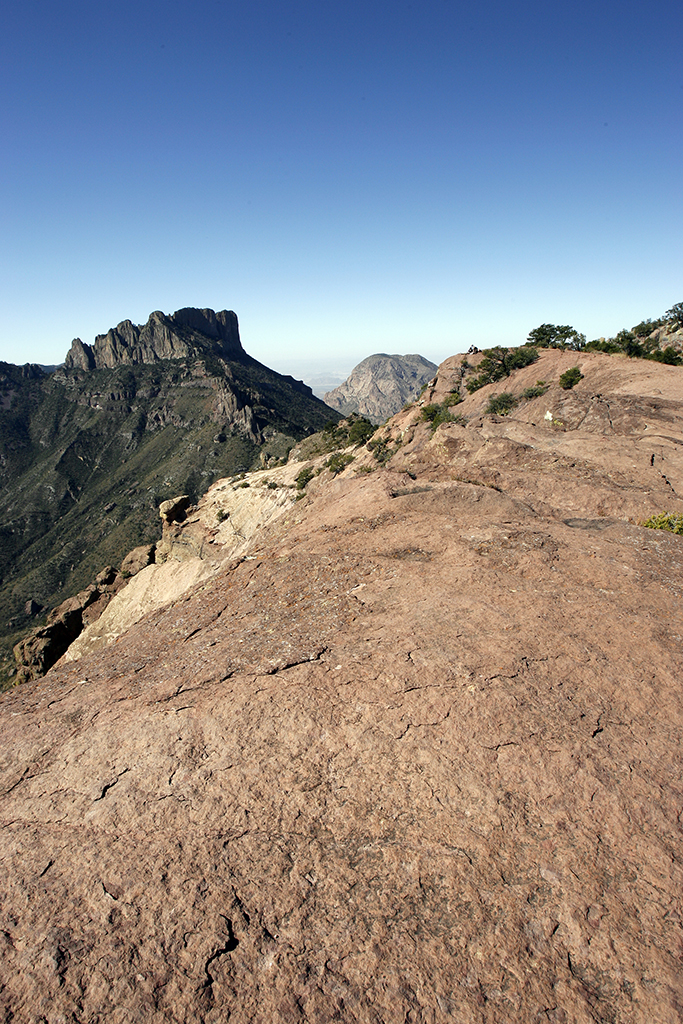
About a mile into the trail, a short set of switchbacks leads up to a saddle between valleys. From there, the view stretches out into Juniper Canyon, the edge of the South Rim and on into to Mexico in the distance. A short path along the ridge leads out to “the Lookout”, poised on a point across from Casa Grande. It’s a great place to relax and take in the view, but depending on when you started your hike it may quickly get crowded there.
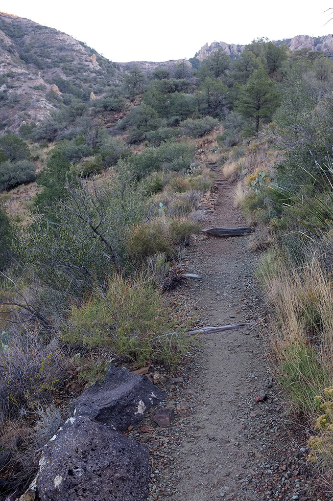
After a rest at the saddle, and a stroll along a grassy hillside, the trail narrows and climbs more steeply through a mile of intermittent switchbacks. If you look up, there’s a large rock far up on the hillside; when you make it there, you won’t have much farther to go.
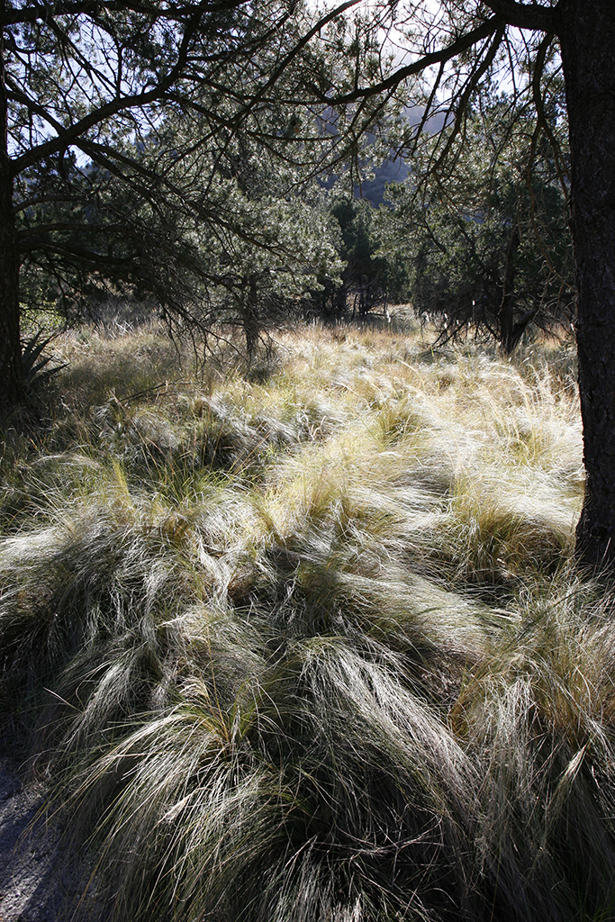
The trail wanders in and out of shade and offers frequent views of Casa Grande and The Window on the way up and back. (On a recent hike of the trail, a trio of bright blue Mexican Jays flew back and forth across path eating nuts in the trees.)
A last scramble over a short stretch of bare red rock is the steepest climb before you emerge on top. The flat path winds through
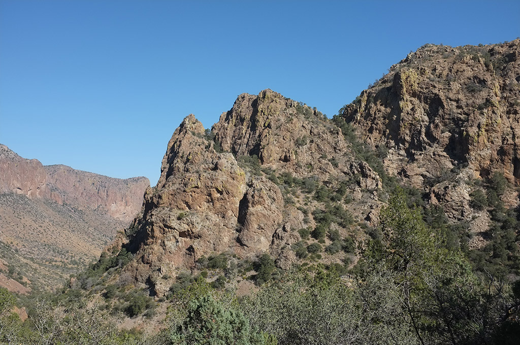
But you’re not done yet. Keep going and the trail pours onto bare rock and takes you out on a point from which you can see Juniper Canyon on one side and Pine Canyon on the other. With nothing but blue sky above, the valleys below and often a brisk wind, the end of the trail has a “top of the world” feeling to it.
Although it’s called the Lost Mine Trail, you never get to Lost Mine Peak (7,535 feet), which looms off in the distance in Pine Canyon.
• • •


